IDataMap is a powerful add-on module to IData® that offers HMI developers the ability to add high performance and high fidelity 2D and 3D digital moving maps to their displays. Suitable for both military and commercial applications, the rich set of features and embedded performance in IDataMap enhance situational awareness capabilities to any type of display.

IDataMap

  • Decreases Development Time — Quickly and easily add 2D or 3D digital maps to a display
  • Reduces Certification Costs — IDataMap DO-178C certification kit eases certification of map displays
  • Robust Performance — Optimized for safety-critical embedded targets
  • Achieve Certifiable Synthetic Vision Applications
IDataMap Displays – 2D or 3D digital maps

Advantages

  • Reduced Development Time — Rapidly develop and deploy display applications using seamless IDataMap module integration with IData, minimizing engineering effort and time to market.
  • Easy-to-Use Interface — Quickly and easily integrate an IDataMap application into existing or new displays with minimal configuration.
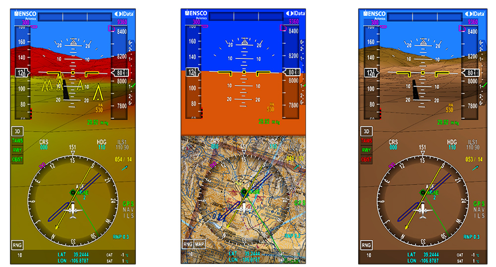
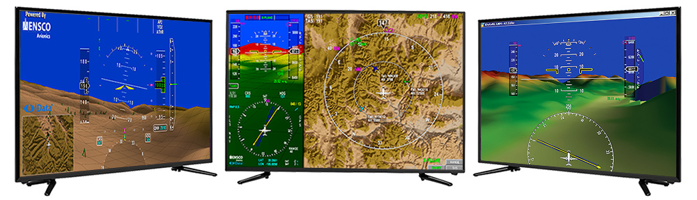
  • Advanced 2D and 3D Terrain Rendering — Create high-performance 2D and 3D geospatial map displays that remain fully geo-synchronized at all times.
  • Enhanced Navigational and Situational Awareness — Display mission-critical data in real time to improve operator awareness and decision-making.
  • Platform-Independent Architecture — Hardware-agnostic solution compatible with any RTOS, processor, or GPU combination, enabling flexible deployment across platforms.
  • DO-178C Certifiable — Certification kit supports DO-178C compliance up to DAL A, meeting the highest FAA Design Assurance Level requirements.

Features

  • High-Performance Rendering — Delivers superior performance using advanced terrain compression algorithms optimized for real-time geospatial displays.
  • Interactive Map Controls — Full support for panning, zooming, rotation, North-Up and Heading-Up modes, including multi-touch interaction.
  • Obstacle and Airspace Rendering — Accurately render runways, airspaces, and terrain obstacles for enhanced situational awareness.
  • Multiple Map Format Support — Native support for DTED Levels 0–3, GeoTIFF, CADRG, satellite imagery, and vector data, with the ability to switch map formats at runtime.
  • Configurable Terrain Color Banding — Define custom RGBA color schemes for user-defined terrain elevation bands.
  • User-Defined Plug-in Architecture — Extend IDataMap functionality with custom plug-ins to meet unique application requirements.
  • Multi-Instance Map Support — Run multiple map instances within a single application, supporting 2D and 3D displays and multiple map types simultaneously.
  • Advanced Georeferenced Symbology — Create rich, fully georeferenced symbology within IData and overlay it directly on map displays.
  • Industry-Standard Compliance — Built on Khronos OpenGL® SC 1.0 and SC 2.0, supporting DO-178C certification and AS9100 quality standards