
Reduce Launch Risk with Advanced Atmospheric Modeling
ENSCO atmospheric modeling helps you anticipate weather impacts, reduce launch risk, and keep critical operations moving with accurate, real-time data.
Atmospheric Modeling
Every launch window depends on a clear understanding of the atmosphere. Shifting conditions can delay operations, affect safety, and add cost. You need to know how weather may change before it disrupts the mission. ENSCO atmospheric modeling gives launch teams the clarity to make timely decisions. We turn complex environmental data into useful insight, helping you protect assets, maintain readiness, and avoid costly surprises. Whether you are planning, assessing, or responding, we help reduce uncertainty so you can move with fewer delays.
Real-Time Models for Real-World Decisions
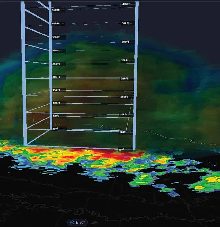
ENSCO integrates atmospheric data from multiple sources, including ground sensors, radar, and satellite feeds, to create high-fidelity models tailored for launch safety. Our systems use advanced algorithms to simulate and forecast conditions that can affect operations, including wind shear, cloud cover, and lightning risk. The result is a clear, current view of atmospheric threats in formats decision-makers can use.
Tailored, Reliable Modeling
ENSCO atmospheric modeling adapts to your operational needs. We support configurable model domains, flexible data inputs, and custom visualization. Our systems are built for reliable, continuous operation so you can trust the data when timing matters.
Decisions Backed by Data
Accurate atmospheric modeling helps you identify launch constraints early, assess risk, and make informed go/no-go decisions. Our approach helps reduce unnecessary holds and improve safety margins to support compliance with operational standards.
Atmospheric Modeling
Find answers to common questions about ENSCO atmospheric modeling capabilities.

Talk to an Atmospheric Modeling Specialist
Ready to improve weather readiness for launch operations? Connect with ENSCO to discuss how atmospheric modeling can support your team.